


Plateau d'Emparis

ezorzet
User
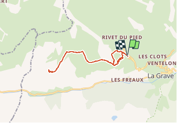

Length
14.5 km

Max alt
2456 m

Uphill gradient
803 m
Km-Effort
25 km

Min alt
1737 m

Downhill gradient
802 m
Boucle
Yes
Creation date :
2020-07-08 05:16:50.008
Updated on :
2020-07-08 15:54:26.149
7h30
Difficulty : Medium

FREE GPS app for hiking
 SityTrail
IGN / Geographical institutes
SityTrail Plus
The world is yours!
About
Trail Walking of 14.5 km to be discovered at Provence-Alpes-Côte d'Azur, Hautes-Alpes, La Grave. This trail is proposed by ezorzet.
Description
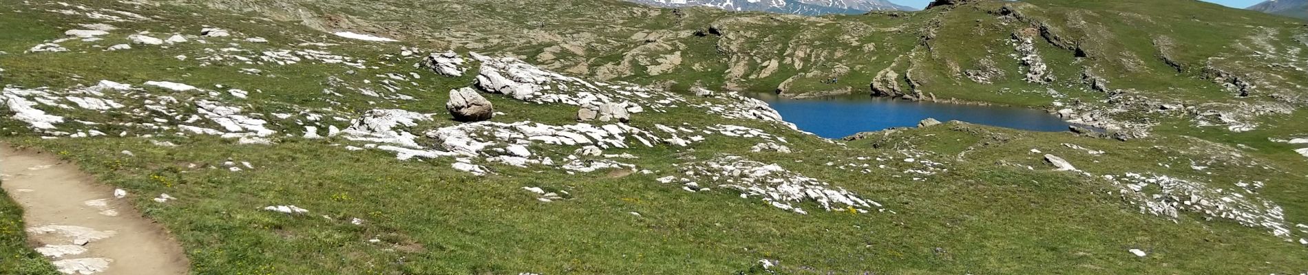
Plateau Emparis depuis le Chazelet.
Photos


Positioning
Country:
France
Region :
Provence-Alpes-Côte d'Azur
Department/Province :
Hautes-Alpes
Municipality :
La Grave
Location:
Unknown
Start:(Dec)
Start:(UTM)
286110 ; 4992707 (32T) N.
Comments